![[Photo: Urban environment]](/images/strecken/atc-foto-stadtumgebung-big.jpg)
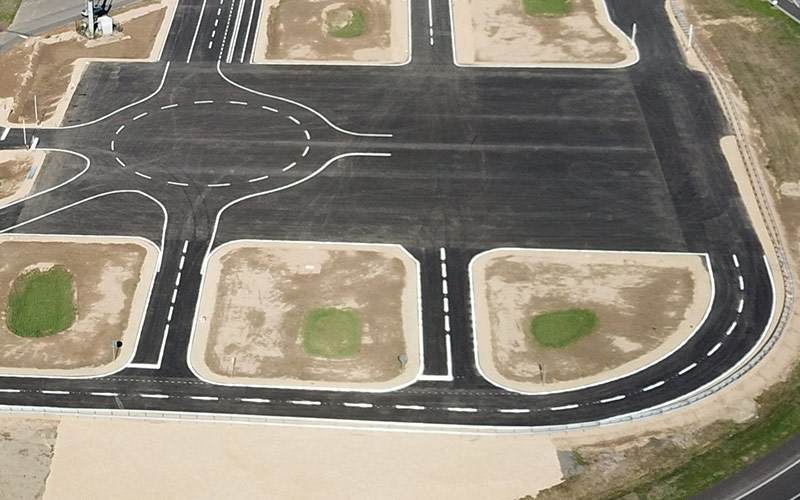
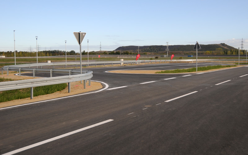
Our city environment allows the simulation of almost all traffic situations that can occur in the city center. This includes traffic light intersections, traffic circles, parking areas, crosswalks, bus stops and much more. The route sections are designed in such a way that they can be adapted very variably to the needs of the users.
![[Location: Urban environment]](/images/strecken/lage/atc-stadtumgebung-lage.svg)
The city environment also includes variable house backdrops made of concrete blocks as well as markings and signage that can be placed individually. Like the entire Aldenhoven Testing Center, the city environment is fully networked and connected to broadband. Thanks to Vodafone's 5G Mobility Lab, this includes latest-generation cellular standards, various WiFis, and traffic lights that communicate according to the V2X standard. The urban environment was built by RWTH Aachen University thanks to a grant from the German Federal Ministry of Education and Research. It is now being operated by the Aldenhoven Testing Center and is integrated into the familiar processes on site.

Intersections / Straights
The intersections and straight lines are highly variable and can thus be varied over a wide range for the respective test case in terms of their lane guidance as well as the simulated building backdrops. They also have close-meshed connection options for sensors as well as positions for traffic signals, signage and lighting.

Multi-functional area
The multifunctional surface is 65 x 100 m2 in size. It has a max. longitudinal slope of 1 % and a cross slope of 0 %. The area has numerous access roads and an observation stand. Individual lane markings and structural traffic circles are possible.

Parking area
Parking spaces of different orientation and edging (such as curbs, banks, guardrails) are available in the parking areas. They can be equipped with parking sensors.
The following booking options are available for the urban environment:
- The entire urban environment (areas A and B) can be booked both exclusively and non-exclusively.
- For tests with increased risk potential (e.g. highly automated, teleoperated or autonomous vehicles), at least one area must be booked exclusively.
- If one area is already exclusively booked, the other area can be booked exclusively or non-exclusively at the same time.
Urban Area A
Parameter
| Intersections | K1 |
|---|---|
| Surface | Asphalt |
| Maximum length of approach [m] | 170 |
| Width in intersection area [m2] | 17 x 17 |
| Distance of connection points [m] (network and power) |
15 |
| Lane setup | variable, up to 5 |
| Artificial buildings | variable, built of concrete |
| Traffic lights | yes, V2X |
| Straights | G1 |
| Length [m] | 210 |
| Width [m] | 7 – 17 |
| Multi-functional area | |
| Surface | Asphalt |
| Length x Width [m2] | 50 x 65 |
| Cross slope [%] | 0 |
| Longitudinal slope [%] | 1 (SE to NW) |
| Markings | variable, according to customer requirements |
Urban Area B
Parameter
| Kreuzungen | K2 | K3 |
|---|---|---|
| Surface | Asphalt | Asphalt |
| Maximum length of approach [m] | 190 | 50 |
| Width in intersection area [m2] | 17 x 8 x 7 | 8 x 7 |
| Distance of connection points [m] (network and power) |
15 | 20 |
| Lane setup | variable, up to 3 | variable, up to 3 |
| Artificial buildings | variable, built of concrete or wood | none |
| Traffic lights | yes, V2X | yes, V2X |
| Euro NCAP Protocol | AEB VRU Version 3.0.2, July 2019 CCFTap Version 3.0.1, Fabruary 2019 |
|
| Straights | G2 | G3 |
| Length [m] | 260 | 130 |
| Width [m] | 7 – 8 | 8 |
| Multi-functional area | ||
| Surface | Asphalt | |
| Length x Width [m2] | 50 x 65 | |
| Cross slope [%] | 0 | |
| Longitudinal slope [%] | 1 (SE to NW) | |
| Markings | variable, according to customer requirements | |
| Euro NCAP Protocol | AEB VRU Version 3.0.2, July 2019 CCFTap Version 3.0.1, February 2019 |
|
![[Logo: Aldenhoven Testing Center]](https://www.aldenhoven-testing-center.de/images/atc-logo-a-ohne-schatten-rgb.svg)
![[Schema: Urban environment]](/images/strecken/schema/atc-stadtumgebung-schema-de.svg)
![[Photo: Urban Area A]](/images/strecken/stadtbereiche/stadtbereich-a-foto.webp)
![[Schema: Urban Area A]](/images/strecken/stadtbereiche/stadtbereich-a-schema.png)
![[Photo: Urban Area B]](/images/strecken/stadtbereiche/stadtbereich-b-foto.webp)
![[Schema: Urban Area B]](/images/strecken/stadtbereiche/stadtbereich-b-schema.png)